


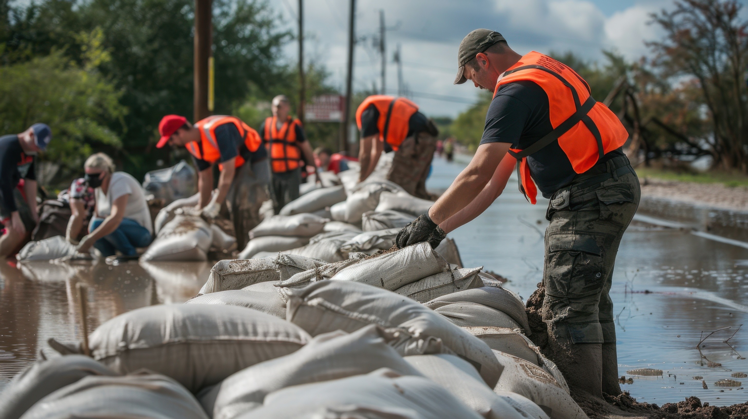
The AI Powered Foundation for
Disaster Resilience.
The all-in-one Intelligence Platform empowering governments and businesses to prepare for, respond to, and rapidly recover from severe weather.
Request A Demo
The AI Powered Foundation for
Disaster Resilience.
The all-in-one Intelligence Platform empowering governments and businesses to prepare for, respond to, and rapidly recover from severe weather.
Request A Demo
The AI Powered Foundation for
Disaster Resilience.
The all-in-one Intelligence Platform empowering governments and businesses to prepare for, respond to, and rapidly recover from severe weather.
Request A Demo
The AI Powered Foundation for
Disaster Resilience.
The all-in-one Intelligence Platform empowering governments and businesses to prepare for, respond to, and rapidly recover from severe weather.
Request A Demo
The AI Powered Foundation for
Disaster Resilience.
The all-in-one Intelligence Platform empowering governments and businesses to prepare for, respond to, and rapidly recover from severe weather.
Request A Demo
OUR MISSION
OUR MISSION
OUR MISSION
To democratize earth intelligence and empower communities with tools to build resilience.
To democratize earth intelligence and empower communities with tools to build resilience.
To democratize earth intelligence and empower communities with tools to build resilience.


Rapid Damage Assessments
FEMA disaster declarations are harder to secure than ever. Terrafort combines remote sensing with an offline-first, AI-powered voice app to document damage from the field in record time.
Quick Impact Analysis
Understand the full scope of disaster impact at record speed.
FEMA-Ready Documentation
Automatically generate Damage Dimensions and Descriptions (DDDs), scopes of work, and cost estimates.
Faster Recovery
Dramatically reduce the time it takes to secure declarations and unlock crucial recovery funding. No more waiting for FEMA.


AI Powered Map Builder
Seamlessly bridge the gap between ESRI and open-source geospatial data. Terafort’s built-in AI Cartographer does the heavy lifting for you.
Instant Visualization
Ask the AI to style, manipulate, and map complex data sets in seconds.
Google Earth & Streetview
All the features you love from Google Earth, plus the ability to integrate all of your geospatial data, including Esri ArcGIS.
Common Operating Picture
(COP) - Create a single, unified source of truth so everyone—from the command center to the front lines—is acting on the same real-time data.


Proactive Weather Intelligence
Stay ahead of the storm. Our built-in weather intelligence engine constantly predicts, monitors, and analyzes severe conditions. Powered by Google WeatherNext 2.
End-to-End Tracking
Get hyper-accurate weather insights before the event strikes, during the impact, and after the skies clear. Don't just react—anticipate.

Streamlined Field Operations
Take total control of your ground response. Our field operations tool ensures your resources are deployed exactly where they are needed most.

Tactical Deployment
Easily manage field teams and dispatch personnel to specific locations.
Targeted Focus
Quickly assign, update, and monitor critical Areas of Interest (AOIs) as the disaster unfolds to keep teams safe and efficient.


Rapid Damage Assessments
FEMA disaster declarations are harder to secure than ever. Terrafort combines remote sensing with an offline-first, AI-powered voice app to document damage from the field in record time.
Quick Impact Analysis
Understand the full scope of disaster impact at record speed.
FEMA-Ready Documentation
Automatically generate Damage Dimensions and Descriptions (DDDs), scopes of work, and cost estimates.
Faster Recovery
Dramatically reduce the time it takes to secure declarations and unlock crucial recovery funding. No more waiting for FEMA.
AI Powered Map Builder
Seamlessly bridge the gap between ESRI and open-source geospatial data. Terafort’s built-in AI Cartographer does the heavy lifting for you.
Instant Visualization
Ask the AI to style, manipulate, and map complex data sets in seconds.
Google Earth & Streetview
All the features you love from Google Earth, plus the ability to integrate all of your geospatial data, including Esri ArcGIS.
Common Operating Picture
(COP) - Create a single, unified source of truth so everyone—from the command center to the front lines—is acting on the same real-time data.
Proactive Weather Intelligence
Stay ahead of the storm. Our built-in weather intelligence engine constantly predicts, monitors, and analyzes severe conditions. Powered by Google WeatherNext 2.
End-to-End Tracking
Get hyper-accurate weather insights before the event strikes, during the impact, and after the skies clear. Don't just react—anticipate.
Streamlined Field Operations
Take total control of your ground response. Our field operations tool ensures your resources are deployed exactly where they are needed most.
Tactical Deployment
Easily manage field teams and dispatch personnel to specific locations.
Targeted Focus
Quickly assign, update, and monitor critical Areas of Interest (AOIs) as the disaster unfolds to keep teams safe and efficient.
Natural Language
Natural Language
Chat with your data - "Heatmap drought risks to ag fields"—and watch insights unfold.
Chat with your data - "Heatmap drought risks to ag fields"—and watch insights unfold.
Seamless Integrations
Seamless Integrations
Pull in Esri ArcGIS layers, Google Earth Engine imagery, or CSV uploads effortlessly.
Pull in Esri ArcGIS layers, Google Earth Engine imagery, or CSV uploads effortlessly.
Curated Climate Data
Curated Climate Data
Pre-loaded datasets from NOAA, NASA, and more—fresh, authoritative, ready to query.
Pre-loaded datasets from NOAA, NASA, and more—fresh, authoritative, ready to query.
Dynamic Visuals
Toggle satellite, 3D terrain, or risk overlays to create dynamic graphs and tables.
Predictive Edge
Predictive Edge
Forecast scenarios like "El Niño effects on port operations" with built-in modeling.
Forecast scenarios like "El Niño effects on port operations" with built-in modeling.
Team-Ready Security
Team-Ready Security
Role-based access keeps sensitive data locked down while insights flow freely.
Role-based access keeps sensitive data locked down while insights flow freely.
MEET THE TEAM
MEET THE TEAM

Grady Joseph
Grady Joseph
Grady Joseph
Chief Executive Officer
Chief Executive Officer
12 years in Emergency Management, serving with FEMA and as Assistant Director of Recovery Operations and Logistics at Cal OES as a Governor appointee.
12 years in Emergency Management, serving with FEMA and as Assistant Director of Recovery Operations and Logistics at Cal OES as a Governor appointee.
12 years in Emergency Management, serving with FEMA and as Assistant Director of Recovery Operations and Logistics at Cal OES as a Governor appointee.

Jake Joseph
Jake Joseph
Jake Joseph
Director of Field Operations
Director of Field Operations
10 years of experience in Emergency Management, serving in field leadership roles with FEMA and in the private sector supporting local governments.
10 years of experience in Emergency Management, serving in field leadership roles with FEMA and in the private sector supporting local governments.

Art Haddad
Art Haddad
Art Haddad
Chief Technology Officer
Chief Technology Officer
30 years of experience creating and managing cloud-based enterprise and SaaS products, served as CTO of Locations Analytics at Esri.
30 years of experience creating and managing cloud-based enterprise and SaaS products, served as CTO of Locations Analytics at Esri.

Ready To Fortify Your Future?
Don't let the next storm—or shift—catch you off guard. You’re just one step away from a demo of the future’s leading geo-technology.
Don't let the next storm—or shift—catch you off guard. You’re just one step away from a demo of the future’s leading geo-technology.
Free Trial
Try TerraFort for a 7 day free trial period before you buy.
Expert Onboarding
Our team will guide your first integration.
Enterprise Scale
Custom plans for high stakes operations and complex workflows.
Get In Touch For Pricing
Ready To Fortify Your Future?
Don't let the next storm—or shift—catch you off guard. You’re just one step away from a demo of the future’s leading geo-technology.
Free Trial
Try TerraFort for a 7 day free trial period before you buy.
Expert Onboarding
Our team will guide your first integration.
Enterprise Scale
Custom plans for high stakes operations and complex workflows.
Get In Touch For Pricing